

Special Consultative Procedure maps and supplementary material

Westport flood map (with 1:67 year flood protection scheme in place) showing town free of flooding

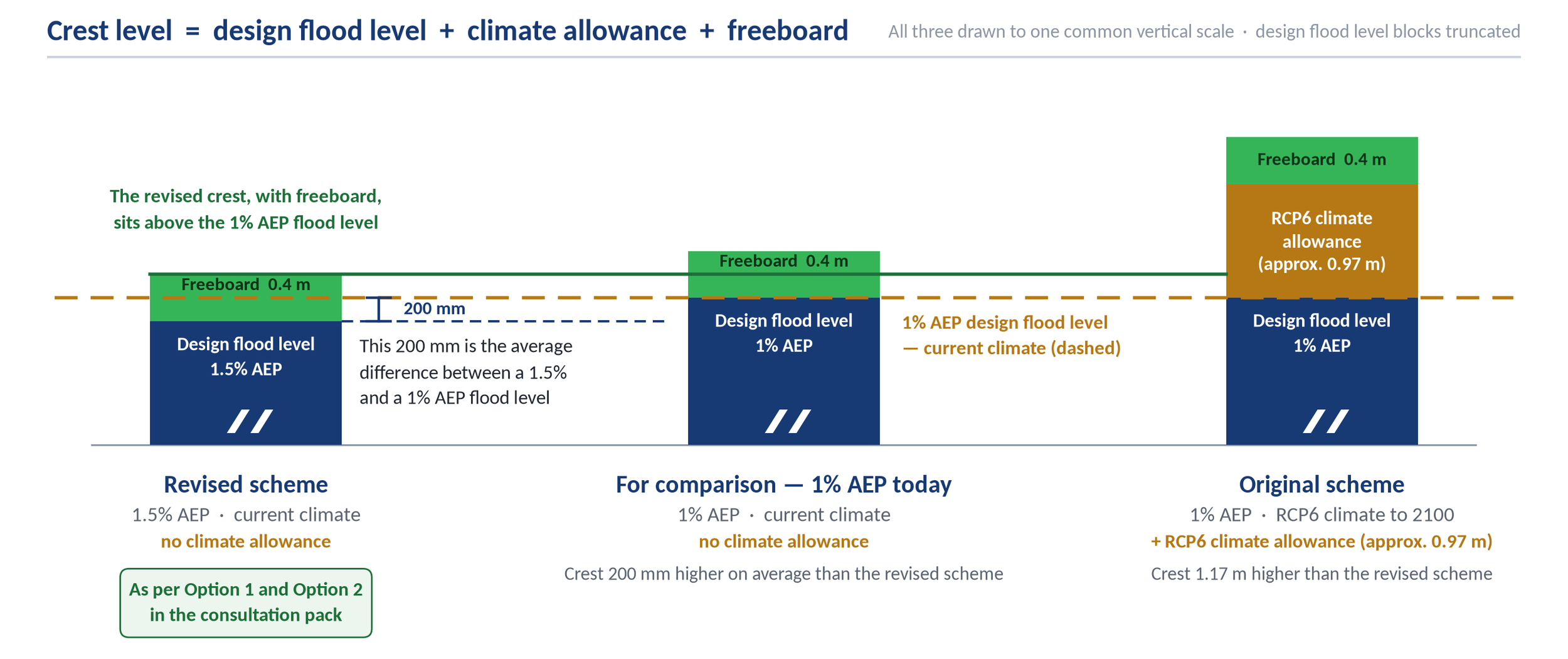
Diagram (below) representing the difference in crest level (height of stopbank) between the revised flood scheme, a 1% AEP Scheme (with climate allowance) and the original scheme as proposed in 2024.
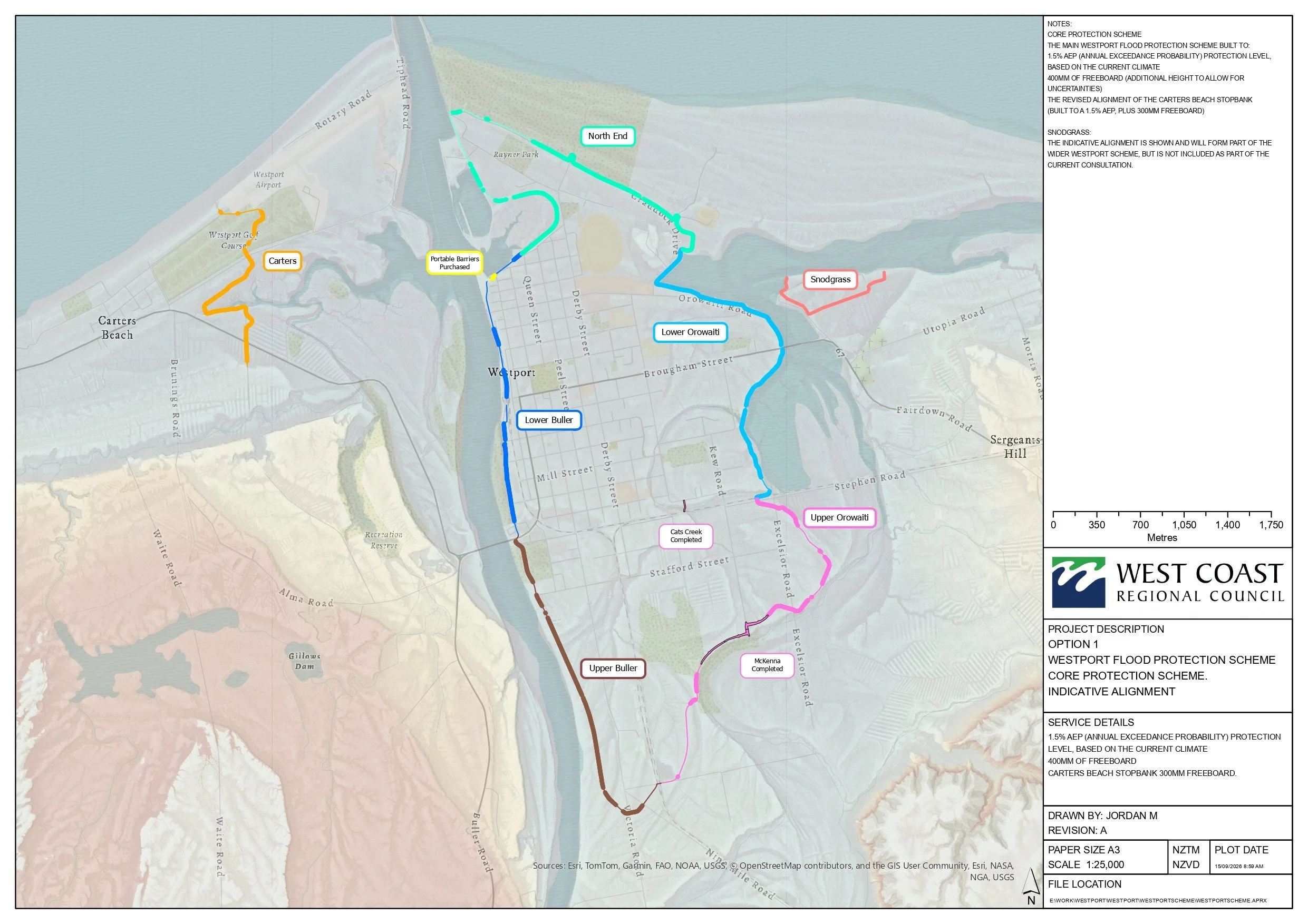
Option 1
Westport Flood Protection Scheme
Core protection scheme
(indicative alignment)
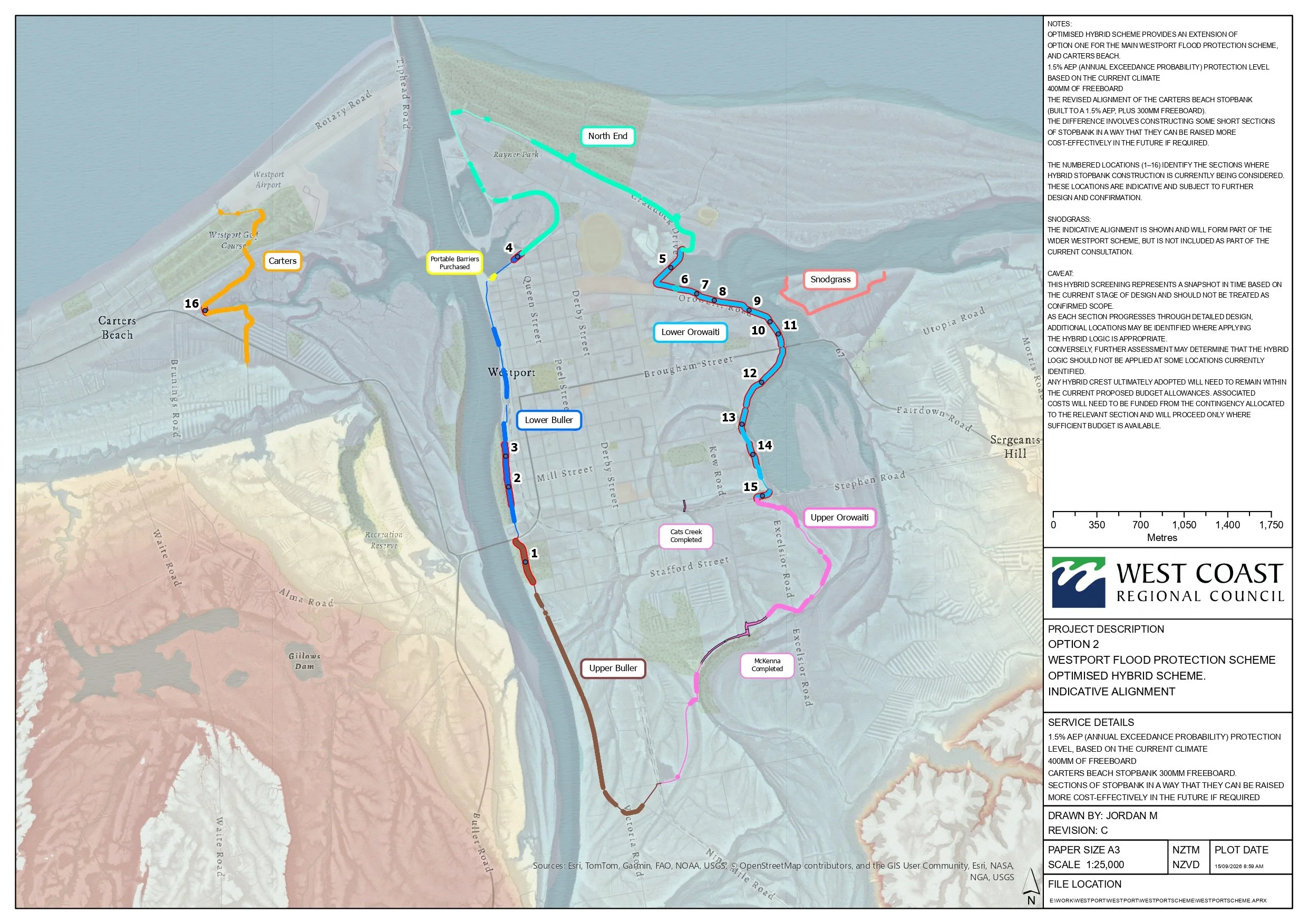
Option 2
Westport Flood Protection Scheme
optomised hybrid scheme
(indicative alignment)

Planned overall construction programme
(Map based on alignment prior to the Westport Flood Protection Scheme reset and consultation in September/October 2026)
You can also download a pdf of this map here.