
Frequently Asked Questions-
Westport Flood Protection Scheme
Frequently Asked Questions (FAQs)
June 2026
We frequently hear certain questions about the scheme and hope these FAQs can shed some light:
When did the project team get started?
The Resilient Westport Flood Protection Scheme has effectively been operating for around 2 and a half years (since early 2024).
What was the project establishment timeline?
After the floods of 2021 and 2022, a business case was put to government to co-fund flood resilience for Westport.
In May 2023, government announced a $22.9 million funding package (Resilient Westport). In September 2023, the Department of Internal Affairs approved the $15.6 million funding for flood protection.
A technical review of the structural concept for the scheme was carried out between November 2023 and February 2024.
After this, real work began on scoping out the flood protection project.
How long could the scheme take to build?
Flood protection projects of comparable scale and size can realistically take 5 to 10 years to complete. We think we can be faster than that and predict the scheme may take another two to three years to deliver from this point.
How much extra funding will the scheme require?
The Westport Flood Protection Scheme will require extra funding in the future. We predict this might be in the vicinity of $10 to $15 million above the original $25.8 million combined funding for the original scheme, which was based on rough order costs.
Such a situation is to be expected for a large project like this as it moves from concept design to preliminary and final design, with cost reviews at each stage.
It should be noted, this is not a final financial position. We are working hard to bring this figure down to budget.
What is being done about the funding issues the project is facing?
The engineers, project manager, and design experts are working on a revised scheme.
They will come up with several scenarios to deliver a more affordable scheme, without compromising safety or integrity. Each scenario will require an examination of level of service, stopbank alignment and geometry, technical solutions (seepage, ground conditions, stopbank material) and sequencing (maximising the timing of work and forming realistic timeframes).
When will this be?
We expect this to be complete by August 2026.
What is the project team doing to obtain additional funding?
We are always looking at alternative funding options.
There is an application to the Regional Infrastructure Fund (RIF) for additional funding, which we await the outcome of. We have been updating our government funders, and they remain committed to helping us deliver this scheme for Westport.
There is a pledge from several local businesses of around $1.8 million, which can be directed to structural works at Carters Beach and/or Snodgrass Road.
The WCRC also recently pledged an additional $1 million from its investment fund towards the flood protection project, which will assist in bringing down any shortfall.
What is the plan for Carters Beach and Snodgrass Road?
It is still the project’s intention to deliver these flood protections.
They were not funded by central government, despite being including in the Kawatiri Business Case request for co-funding.
The funding pledge from local businesses is yet to be applied as design and wider funding conversations continue. The first application of that funding is likely to be Carters Beach, with Snodgrass Road coming later.
If less funding was provided than hoped for, why did work start on the scheme?
The scheme has always been progressed in good faith. The belief at the beginning was that it could be delivered within budget.
Over time, the level of complexity of the scheme and the range of challenges it faces became clearer. Hence the decision to commence a value engineering process to drill down into the scheme in detail and provide a more achievable road map for where to from now.
Will rates be affected?
We know that Carters Beach, Snodgrass Road and some of the Organ’s Island work were not funded by government following the original business case for co-funding. If the time comes that local share is needed, we will have a conversation with the community on these elements.
Our value engineering process is focusing on balancing the level of protection, affordability, and insurability in a way the community can sustain. In simple terms, we aim to ensure that any contribution to the flood protection scheme by rates is offset by insurance benefits to ratepayers.
In the meantime, we are doing our best to find alternative funding sources and acknowledge the pledged funding from a number of local businesses.
What is the process once the project team has come up with a revised scheme definition and costings?
The Westport Flood Protect Scheme Control Group will consider the options and present them to the Westport Rating District Joint Committee, and the West Coast Regional Council. The proposal will then need to be presented to NIFFCo, who manages the government’s infrastructure funding on behalf of Department of Internal Affairs (DIA).
How is the project engaging with insurers around the cost issue and possible change in levels of service?
Once the team has come up with a range of scenarios to deliver a more affordable scheme, these will be discussed with the insurance industry to understand and define the insurance impact.
What Resource Consent Applications are pending?
There are Resource Consent applications underway for the Floating Lagoon stopbank, as well as a joint application for Carters Beach and Upper Buller. We continue to work with the consenting authorities to facilitate those consents. Good progress is being made.
What are the design and construction challenges?
Our investigations have confirmed that many sections of the floodwalls face technical and constructability challenges, including seepage, stability, constrained corridors (narrow areas near homes or roads), utilities and contaminated land.
We are committed to resolving these issues because of their importance. Key decisions are still being worked through on matters such as seepage treatment, floodwall types and fill sources, because these have material implications for affordability and buildability.
What is level of service?
Level of service relates to the way flood protection works are designed and constructed and can include the height of the flood you are protecting against, future climate provisioning (how much extra height we build into the scheme to allow for future climate change), and freeboard (additional stopbank height to address uncertainties). These are all variables that are included in our value engineering process.
What is value engineering?
Value engineering is carried out to help improve the project's value by looking at the relationship between cost, quality, and performance. The focus is on looking at cost savings, optimising performance, improving decision-making and deliverables. This is standard practice on large construction projects. Value engineering takes time when dealing with a number of complex variables.
What is the strategy for land access?
We estimate there are 83 parcels of land directly affected by the planned floodwalls.
This includes private, Council (BDC), and Crown/reserve land. A comprehensive Land Access Strategy is being developed to help manage the process.
The goal is to establish trust and transparency with landowners, secure legally sound access rights and property agreements, minimise project delays, ensure environmental, cultural, and community considerations are respected and build long-term relationships that support future access needs for maintenance.
The strategy the team has put together ensures a co-ordinated approach to engaging with landowners, to ensure they are guided through the process with as much transparency as possible.
How many people have already been spoken to in relation to land access?
The WFPS team has been dealing with landowners throughout the scheme in relation to access to land, for geotechnical drilling for example.
Where we think a landowner might reasonably be affected by a planned stopbank, we have had preliminary conversations with them. To date, this includes people and groups in and around Carters Beach, as well as Upper Buller, Upper Orowaiti and Floating Lagoon, and those in the vicinity of the Avery’s stopbank.
We will continue to do so once we get closer to building in specific areas. This will happen more as the designs progress and more specific access requirements are known. We can’t finalise agreements until we have final designs.
Why haven’t more land access agreement been reached?
We have access agreements in place for the McKenna’s stopbank area, three License to Occupy agreements with Buller District Council and the O’Conor Home site, as these have been required to carry out work.
For the remaining parcels, the project team has not yet sought to finalise access agreements, as detailed designs and alignments are still being developed.
Until alignments, design footprints, construction requirements and long-term maintenance access requirements are sufficiently defined, we aren’t in a position to confirm the exact land access requirements with affected landowners.
What external skills are required to help deliver the project?
A large number of skilled professionals are required to deliver a project of this scale, technical complexity, and regulatory burden.
These include: geotechnical drilling and investigation; civil, structural and geotechnical engineering design (across concept, preliminary, detailed and final design stages); hydraulic and flood modelling; ecological investigations; contaminated land and environmental site investigation; archaeological and heritage assessment; resource consent preparation and planning; independent peer review of designs and technical reports; quantity surveying and cost estimation; land access and property support; communications and community engagement; and project management support.
Many of these specialist inputs are required by regulation or by the conditions of our funding arrangements — they are not discretionary. Independent peer review, in particular, is a deliberate quality assurance measure to ensure the public can have confidence in the technical rigour of the scheme's design.
How does Buller District Council (BDC) fit in with the WFPS?
BDC is an important partner in everything we are doing. As well as working with the Buller District Council on access agreements where our work overlaps onto Council-owned land, we are fully co-operating with them to integrate our floodwalls with their planned stormwater works.
This is the most efficient and cost effective approach - for stormwater outlet pipes, allowing water to flow out of Westport during severe flooding events, to be built into the stopbanks during construction.
BDC also independently processes our Resource Consent Applications, and we work closely with them on any questions that arise during that process.
We are also work on improving our communications with the council at all levels.
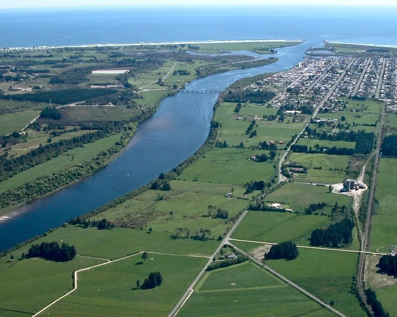
Why not just dredge the river some more?
It is considered that dredging would not contribute much to flood risk mitigation in Westport.
The Buller River has the power, in large flood events, to determine its own bed levels and bed profile and will scour and deposit bed material to suit its very high sediment transport capacity.
The Buller River channel, along its lower reaches and out to the river mouth bar, has been dredged for harbour development and maintenance purposes for many years. Rock tide walls have been used to confine flows in the main channel. This experience has indicated this has not had much effect on the bar or on channel depths.
Dredging/gravel extraction is costly and without commercial demand for the aggregate, dredging would come at significant ongoing cost.
The benefits of gravel extraction are also not reliable, with even small river floods having the ability to replace extracted gravel overnight.
Why not consider the ‘Orowaiti cut’?
We continually get asked why the ‘overflow’ cut is not being done.
This option was put forward for consideration by the technical Advisory Group that advised Buller Flood Recovery in the immediate post-flood environment. We have looked closely at all the advice on this proposed solution. The proposed cut was suggested as best located where the Orowaiti Estuary bends to the east. The cut was envisaged as allowing flow to go directly out to the sea, through the spit, thereby preventing higher than wanted ponding of upriver floodwater flows.
The advice received was that the long length of a cut between the estuary and the current coastline, and the lack of hydraulic gradient at this location, would make any overflow cut option inefficient.
The cut would have to be wide and shallow to have sufficient capacity while still fitting the level limitations of the estuary and sea.
Advice taken in 2022 is that the cost just to excavate the Cut would be in the region of $5 million.
Maintenance of the cut would need to be relatively constant due to inevitable silt and sediment build-up and would involve significant cost.
The coastline has been growing since the early 1900’s and is expected to continue to do so. This means it would become harder and harder to keep the Cut open over time.
Sea level rise is also expected to continue to increase, further potentially threatening the efficacy of a Cut.
An opening in this area would significantly increase the risk of sea surge and tsunami hazards to residents of Westport. Our experts believe it would enable the propagation of damaging coastal waves through the lower Orowaiti area during major sea storms.
You can watch the video of Land, Sea, River Consulting river engineer Matt Gardner as he answers questions about the Orowaiti Cut and why it was first considered, then ruled out. Matt has extensive experience on the West Coast advising on river modelling. Go to about 26 and a half minutes to see this section.
https://youtu.be/lwdh_FUzQ8M?feature=shared
You may ALSO be interested in:
Media Release: Drill rig to be spotted around Westport
Media Release Snodgrass Road: Report into possble flood mitigation options
Media Release: Work on McKenna stopbank wraps up
Media Release: Ceremony to mark the breaking of ground on Mckenna stopbank
Media Release: Work to start on Floating Lagoon vegetation clearance
Media Release: Start of Cats Creek work marks important milestone